
ISRO launched EOS-05 satellite from Sriharikota
At a glance
- ISRO launched the EOS-05 satellite from Sriharikota, Andhra Pradesh on September 4.
- EOS-05 is India's first advanced geostationary imaging satellite.
- The satellite was launched at 02:55 using the GSLV-F17 rocket from Satish Dhawan Space Centre.
- GSLV-F17 was the 19th flight of India's geosynchronous satellite launch vehicle.
- The mission director announced the launch's success 22 minutes after liftoff.
अक्सर पूछे जाने वाले सवाल
- When and where was the EOS-05 satellite launched?
- It was launched on September 4 from Sriharikota, Andhra Pradesh.
- What is special about the EOS-05 satellite?
- It is India's first advanced geostationary imaging satellite.
- Which rocket was used to launch EOS-05?
- The GSLV-F17 rocket was used for the launch.
- Who witnessed the launch of EOS-05?
- ISRO chief V Narayanan and several former chairpersons witnessed the launch.
- What is the objective of the EOS-05 mission?
- To place the satellite into a sub-geostationary transfer orbit and provide important Earth observation data.
AI-निर्मित · पूरी ख़बर से पुष्टि करें
See more of our coverage in your search results.

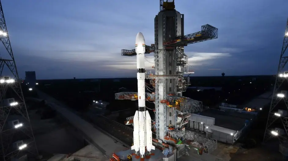
The Indian Space Research Organisation launched the EOS-05 satellite from Sriharikota, Andhra Pradesh on September 4. It is India's first advanced geostationary imaging satellite, released at 02:55 from Satish Dhawan Space Centre via the GSLV-F17 rocket.
The launch was historic in many ways, witnessed by ISRO chief V Narayanan and several former chairpersons. The GSLV-F17 was the 19th flight of India's geosynchronous satellite launch vehicle. The rocket is approximately 51.7 meters long with a lift-off mass of about 420.5 tons. It was launched from the second launch pad at Sriharikota.
The rocket was fitted with a 4-meter diameter ogive composite payload fairing housing the EOS-05 satellite. Three hours after the launch, many astronomy enthusiasts gathered at the ISRO centre. The mission director announced the success of the launch 22 minutes after liftoff.
According to ISRO, the EOS-05 mission aims to place the satellite into a sub-geostationary transfer orbit to orbit the Earth and provide important data.
50 free articles left today
0 of 50 free reads used today.
Most read


Comments
0 threadsNo approved comments yet. Start the discussion.